Geolocate

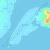
Dita topographic map

Click on the map to display elevation.

About this map

Name: Dita topographic map, elevation, terrain.

Location: Dita, Zamboanga City, Zamboanga Peninsula, 7000, Philippines (7.17425 122.23378 7.21425 122.27378)

Average elevation: 3 m

Minimum elevation: -2 m

Maximum elevation: 115 m

Other topographic maps

Click on a map to view its topography, its elevation and its terrain.

Vitali River

Philippines > Zamboanga City > Mangusu

Average elevation: 27 m

Sacol Island

Philippines > Zamboanga City

Average elevation: 6 m

Sinunug Island

Philippines > Zamboanga City

Average elevation: 0 m

Plaza Pershing

Philippines > Zamboanga City

Average elevation: 4 m

Gear up for your next adventure:

🩹Moleskin Blister Pads - Direct protection for painful foot pressure points
🥤Collapsible Travel Cup - Saves space and weight in your mess kit
🔨Vehicle Emergency Tool - Safety tool for remote road trips to trailheads
🧥Waterproof Hiking Jacket - Protect yourself from rain and wind while hiking
🎒Hiking Daypack - Lightweight and durable backpacks for day trips and excursions

As an Amazon Associate, this site earns from qualifying purchases at no extra cost to you.