Geolocate

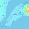
Taguiti topographic map

Click on the map to display elevation.

About this map

Name: Taguiti topographic map, elevation, terrain.

Location: Taguiti, Zamboanga City, Zamboanga Peninsula, 7000, Philippines (7.25928 122.25360 7.29928 122.29360)

Average elevation: 102 m

Minimum elevation: -3 m

Maximum elevation: 404 m

Other topographic maps

Click on a map to view its topography, its elevation and its terrain.

Sacol Island

Philippines > Zamboanga City

Average elevation: 6 m

Vitali River

Philippines > Zamboanga City > Mangusu

Average elevation: 27 m

Sinunug Island

Philippines > Zamboanga City

Average elevation: 0 m

Plaza Pershing

Philippines > Zamboanga City

Average elevation: 4 m

Gear up for your next adventure:

🧴Outdoor Sunscreen - High SPF protection for high-altitude UV exposure
🧤Thermal Hiking Gloves - Grip-enhanced gloves for cold-weather altitude trekking
🪜Heavy Duty Carabiners - Multi-use clips for securing gear to your backpack
⛺Bushcraft Tarp - Versatile emergency shelter or gear protection
🥾Hiking Boots - Sturdy boots providing ankle support and traction on rugged trails

As an Amazon Associate, this site earns from qualifying purchases at no extra cost to you.