Geolocate

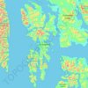
Point Alexander topographic map

Click on the map to display elevation.

About this map

Name: Point Alexander topographic map, elevation, terrain.

Location: Point Alexander, Petersburg Borough, Alaska, United States (56.51078 -132.94727 56.51088 -132.94717)

Average elevation: 78 m

Minimum elevation: 0 m

Maximum elevation: 376 m

Other topographic maps

Click on a map to view its topography, its elevation and its terrain.
Kuiu Island

United States > Alaska > Petersburg Borough

Average elevation: 107 m

Petersburg

United States > Alaska > Petersburg Borough

Average elevation: 223 m

Petersburg

United States > Alaska > Petersburg Borough

Average elevation: 223 m

Gear up for your next adventure:

🧢Sun Protection Cap - Breathable cap to protect from sun exposure
🧭Orienteering Kit - Tools for map reading and navigation in the wild
🧢Hiking Sun Hat - Wide-brimmed protection for exposed mountain ridges
🏕️Camping Hammock - Integrated protection for sleeping between trees
🥽Outdoor Goggles - Protective eyewear for outdoor activities

As an Amazon Associate, this site earns from qualifying purchases at no extra cost to you.