Geolocate

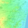
Thiruninravur topographic map

Click on the map to display elevation.

About this map

Name: Thiruninravur topographic map, elevation, terrain.

Location: Thiruninravur, Poonamallee, Thiruvallur, Tamil Nadu, 602024, India (13.07889 79.99319 13.15889 80.07319)

Average elevation: 32 m

Minimum elevation: 22 m

Maximum elevation: 54 m

Other topographic maps

Click on a map to view its topography, its elevation and its terrain.
Cooum

India > Tamil Nadu > Poonamallee

Average elevation: 27 m

Gear up for your next adventure:

💧Reusable Water Bottle - Durable water bottles for hydration on trails
🧥Packable Rain Jacket - Breathable waterproof layer for unpredictable weather
🪜Heavy Duty Carabiners - Multi-use clips for securing gear to your backpack
⛺Lightweight Camping Tent - Portable shelter optimized for Canadian backcountry camping
⛺Family Camping Tent - Spacious tent suitable for family camping trips

As an Amazon Associate, this site earns from qualifying purchases at no extra cost to you.