Geolocate

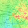
Yangma topographic map

Click on the map to display elevation.

About this map

Name: Yangma topographic map, elevation, terrain.

Location: Yangma, Chengdu, Sichuan, China (30.45868 104.46287 30.53868 104.54287)

Average elevation: 436 m

Minimum elevation: 391 m

Maximum elevation: 502 m

Other topographic maps

Click on a map to view its topography, its elevation and its terrain.
Wuhou District

China > Sichuan > Chengdu

The terrain of Wuhou District is flat, sloping from northwest to southeast, with an average altitude of 502.5 meters. The plains within the territory are composed of flood plains, alluvial fans, fan plains and other plains. The geological structure of the entire region is mainly Quaternary loose accumulations.

Average elevation: 492 m

Jintang County

China > Sichuan > Chengdu

Average elevation: 495 m

Pengzhou

China > Sichuan > Chengdu

Average elevation: 1,161 m

Jinjiang District

China > Sichuan > Chengdu

Average elevation: 498 m

Jinniu District

China > Sichuan > Chengdu

Average elevation: 512 m

Gear up for your next adventure:

⛺Lightweight Camping Tent - Portable shelter optimized for Canadian backcountry camping
🥾Waterproof Trail Shoes - Shoes designed to handle wet terrain
🥾Mountain Trail Shoes - High-traction shoes for mountain trails
🔋Solar Power Bank - Keep your GPS and devices charged during long outdoor trips
🎒Backpack Rain Cover - External shield to keep your entire pack dry

As an Amazon Associate, this site earns from qualifying purchases at no extra cost to you.