Geolocate

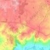
Le Tremblay topographic map

Click on the map to display elevation.

About this map

Name: Le Tremblay topographic map, elevation, terrain.

Location: Le Tremblay, Marchais-en-Brie, Dhuys et Morin-en-Brie, Château-Thierry, Aisne, Hauts-de-France, France métropolitaine, 02540, France (48.86518 3.47493 48.90518 3.51493)

Average elevation: 177 m

Minimum elevation: 111 m

Maximum elevation: 219 m

Other topographic maps

Click on a map to view its topography, its elevation and its terrain.
Gear up for your next adventure:

☕Camping Coffee Maker - Brew fresh coffee anywhere on the topographic map
🔭Compact Binoculars - Lightweight optics for scouting trails and wildlife
🥽Outdoor Goggles - Protective eyewear for outdoor activities
🧴Waterproofing Spray - Restore the DWR coating on jackets and tents
🧰Survival Kit - Essential gear for emergencies in the wilderness

As an Amazon Associate, this site earns from qualifying purchases at no extra cost to you.