Geolocate

Silgadhi topographic map

Click on the map to display elevation.

About this map
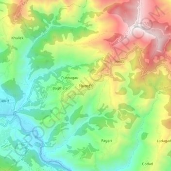
Name: Silgadhi topographic map, elevation, terrain.

Location: Silgadhi, Dipayal Silgadi, Doti, Sudurpashchim Province, Nepal (29.22706 80.94334 29.30706 81.02334)

Average elevation: 1,129 m

Minimum elevation: 501 m

Maximum elevation: 2,174 m

Other topographic maps

Click on a map to view its topography, its elevation and its terrain.

Shikhar

Nepal > Sudurpashchim Province > Doti

Average elevation: 1,488 m

Shikhar

Nepal > Sudurpashchim Province > Doti

Average elevation: 1,488 m

Gear up for your next adventure:

🛶Canoe Life Vest - Safety vest for water sports
🔋Solar Power Bank - Keep your GPS and devices charged during long outdoor trips
🧤Rechargeable Heated Gloves - Extreme warmth for Canadian winter expeditions
🩹Compact First Aid Kit - Pre-packed essentials for common trail injuries
🎒Fully Waterproof Backpack - Total protection for photography gear and electronics

As an Amazon Associate, this site earns from qualifying purchases at no extra cost to you.