Geolocate

Staggiano topographic map

Click on the map to display elevation.

About this map
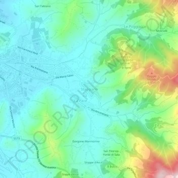
Name: Staggiano topographic map, elevation, terrain.

Location: Staggiano, Arezzo, Toscana, 52100, Italia (43.43439 11.89508 43.47439 11.93508)

Average elevation: 345 m

Minimum elevation: 252 m

Maximum elevation: 625 m

Gear up for your next adventure:

🥾Light Hiking Boots - Lightweight and comfortable boots for day hikes
🧢Hiking Hat - Sun-protective and breathable hats for long treks
⛺Tent Footprint - Protect tent floor and increase durability
🛌Insulated Sleeping Pad - Critical thermal barrier between you and the cold ground
❄️Traction Ice Cleats - Slip-on spikes for icy trails and winter hiking

As an Amazon Associate, this site earns from qualifying purchases at no extra cost to you.