Geolocate

Pendências topographic map

Click on the map to display elevation.

About this map
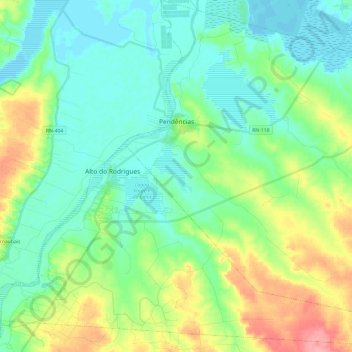
Name: Pendências topographic map, elevation, terrain.

Location: Pendências, Rio Grande do Norte, Northeast Region, Brazil (-5.41200 -36.75400 -5.17503 -36.51477)

Average elevation: 25 m

Minimum elevation: 0 m

Maximum elevation: 87 m

Other topographic maps

Click on a map to view its topography, its elevation and its terrain.
Natal

Brazil > Rio Grande do Norte > Natal

Average elevation: 21 m

Morro do Careca

Brazil > Rio Grande do Norte > Natal

Average elevation: 25 m

Gear up for your next adventure:

🧤Rechargeable Heated Gloves - Extreme warmth for Canadian winter expeditions
🥾Light Trekking Boots - Supportive boots for multi-day treks
🌬️Windproof Camp Stove - Efficient cooking even on exposed mountain peaks
🎒Hiking Backpack - Lightweight and ergonomic backpacks for day hikes or multi-day treks
🛏️Sleeping Bag - Warm and compact sleeping bags for outdoor camping

As an Amazon Associate, this site earns from qualifying purchases at no extra cost to you.