
Mungia topographic map
Interactive map
Click on the map to display elevation.
About this map
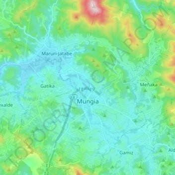
Name: Mungia topographic map, elevation, terrain.
Location: Mungia, Mungialdea, Biscaye, Pays basque, 48100, Espagne (43.31516 -2.89112 43.40713 -2.77463)
Average elevation: 111 m
Minimum elevation: 5 m
Maximum elevation: 578 m