
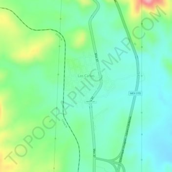
Las Cañas topographic map
Interactive map
Click on the map to display elevation.
About this map
Name: Las Cañas topographic map, elevation, terrain.
Location: Las Cañas, Arteaga, Michoacán de Ocampo, México (18.55994 -101.97965 18.57066 -101.97074)
Average elevation: 347 m
Minimum elevation: 300 m
Maximum elevation: 446 m