
Thank you for supporting this site ❤️
Make a donation
Make a donation
Gear up for your next adventure:
As an Amazon Associate, this site earns from qualifying purchases at no extra cost to you.
Sopegal topographic map
Click on the map to display elevation.
Thank you for supporting this site ❤️
Make a donation
Make a donation
Gear up for your next adventure:
As an Amazon Associate, this site earns from qualifying purchases at no extra cost to you.
About this map
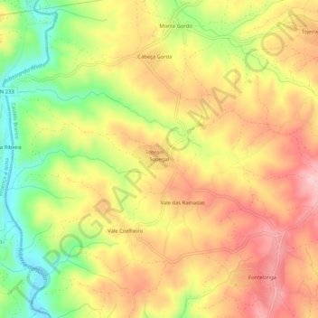
Name: Sopegal topographic map, elevation, terrain.
Location: Sopegal, Santo André das Tojeiras, Castelo Branco, Portugal (39.77182 -7.75602 39.81182 -7.71602)
Average elevation: 291 m
Minimum elevation: 179 m
Maximum elevation: 380 m
Thank you for supporting this site ❤️
Make a donation
Make a donation
Gear up for your next adventure:
As an Amazon Associate, this site earns from qualifying purchases at no extra cost to you.