Geolocate

Großdubrau - Wulka Dubrawa topographic map

Click on the map to display elevation.

About this map

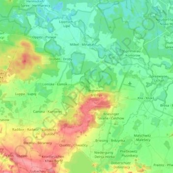
Name: Großdubrau - Wulka Dubrawa topographic map, elevation, terrain.

Location: Großdubrau - Wulka Dubrawa, Bautzen, Saxony, 02694, Germany (51.21473 14.40201 51.32749 14.56595)

Average elevation: 154 m

Minimum elevation: 127 m

Maximum elevation: 209 m

Other topographic maps

Click on a map to view its topography, its elevation and its terrain.

Weickersdorf

Germany > Saxony > Bautzen > Bischofswerda

Average elevation: 299 m

Gear up for your next adventure:

🧢Hiking Sun Hat - Wide-brimmed protection for exposed mountain ridges
🪜Heavy Duty Carabiners - Multi-use clips for securing gear to your backpack
Backpacking Tent - Lightweight tent for long-distance hiking trips
🧥Fleece Jacket - Warm and lightweight jacket for layering
💡Compact LED Flashlight - Powerful and portable flashlight for outdoor use

As an Amazon Associate, this site earns from qualifying purchases at no extra cost to you.