
Borgloon topographic map
Interactive map
Click on the map to display elevation.
About this map
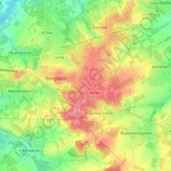
Name: Borgloon topographic map, elevation, terrain.
Location: Borgloon, Tongeren, Limburg, Flanders, 3840, Belgium (50.77853 5.30396 50.82224 5.38077)
Average elevation: 85 m
Minimum elevation: 44 m
Maximum elevation: 126 m
Other topographic maps
Click on a map to view its topography, its elevation and its terrain.
Hendrieken
Hendrieken, Borgloon, Tongeren, Limburg, Flanders, Belgium
Average elevation: 78 m