Geolocate

Luxia topographic map

Click on the map to display elevation.

About this map

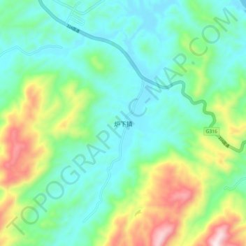
Name: Luxia topographic map, elevation, terrain.

Location: Luxia, Nanping City, Fujian, China (26.45004 118.25611 26.53004 118.33611)

Average elevation: 252 m

Minimum elevation: 58 m

Maximum elevation: 761 m

Other topographic maps

Click on a map to view its topography, its elevation and its terrain.

Shaowu City

China > Fujian > Nanping City

Average elevation: 480 m

Gear up for your next adventure:

🎒Fully Waterproof Backpack - Total protection for photography gear and electronics
🧴Sunscreen SPF - Broad-spectrum sunscreen for outdoor activities
🥾Light Hiking Boots - Lightweight and comfortable boots for day hikes
🔋Emergency Crank Radio - Weather alerts and power without needing batteries
🥤Collapsible Travel Cup - Saves space and weight in your mess kit

As an Amazon Associate, this site earns from qualifying purchases at no extra cost to you.