Geolocate

Miles topographic map

Click on the map to display elevation.

About this map

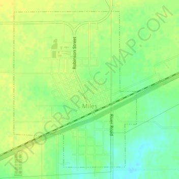
Name: Miles topographic map, elevation, terrain.

Location: Miles, Runnels County, Texas, United States (31.58813 -100.19580 31.61168 -100.17400)

Average elevation: 550 m

Minimum elevation: 537 m

Maximum elevation: 558 m

Gear up for your next adventure:

🥾Trekking Boots - Durable boots for long-distance trekking
🥾Approach Boots - Comfortable boots for hiking and climbing approaches
Camping Coffee Maker - Brew fresh coffee anywhere on the topographic map
Tent Footprint - Protect tent floor and increase durability
👟Trail Running Shoes - Agile footwear for fast-paced topographic exploration

As an Amazon Associate, this site earns from qualifying purchases at no extra cost to you.