Geolocate

Sarin topographic map

Click on the map to display elevation.

About this map

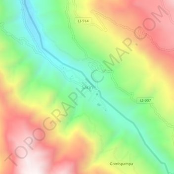
Name: Sarin topographic map, elevation, terrain.

Location: Sarin, Sarín, Province of Sánchez Carrión, La Libertad, Peru (-7.93132 -77.92577 -7.89132 -77.88577)

Average elevation: 3,145 m

Minimum elevation: 2,638 m

Maximum elevation: 3,747 m

Gear up for your next adventure:

🥾Trail Hiking Shoes - Durable shoes designed for rugged trails
🪑Ultralight Camping Stool - Compact seating for rest stops during long hikes
🥾Trekking Poles - Adjustable trekking poles to reduce knee stress and improve stability
🧥Softshell Jacket - Windproof and breathable jacket for hiking
🧥Waterproof Pants - Keep dry during rainy hiking conditions

As an Amazon Associate, this site earns from qualifying purchases at no extra cost to you.