
Te Puna topographic map
Click on the map to display elevation.
About this map
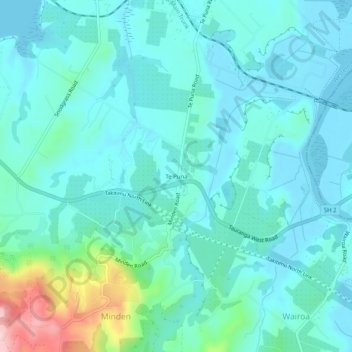
Name: Te Puna topographic map, elevation, terrain.
Average elevation: 22 m
Minimum elevation: -1 m
Maximum elevation: 135 m
Other topographic maps
Click on a map to view its topography, its elevation and its terrain.
Papamoa Hills Regional Park
New Zealand > Bay of Plenty > Western Bay of Plenty District
Average elevation: 58 m
Kaimai Mamaku Conservation Park
New Zealand > Bay of Plenty > Western Bay of Plenty District
Average elevation: 154 m