Geolocate

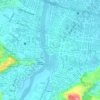
Tuburan topographic map

Click on the map to display elevation.

About this map

Name: Tuburan topographic map, elevation, terrain.

Location: Tuburan, Cagayan de Oro, Northern Mindanao, 9000, Philippines (8.35484 124.48466 8.39484 124.52466)

Average elevation: 152 m

Minimum elevation: 48 m

Maximum elevation: 530 m

Other topographic maps

Click on a map to view its topography, its elevation and its terrain.

Iponan River

Philippines > Cagayan de Oro

Average elevation: 73 m

Calaanan Creek

Philippines > Cagayan de Oro

Average elevation: 70 m

Divisoria Plaza

Philippines > Cagayan de Oro

Average elevation: 11 m

Gaston Park

Philippines > Cagayan de Oro

Average elevation: 13 m

Rodelsa Circle

Philippines > Cagayan de Oro

Average elevation: 19 m

Xavier Heights

Philippines > Cagayan de Oro

Average elevation: 96 m

Agusan River

Philippines > Cagayan de Oro

Average elevation: 197 m

Divisoria Plaza

Philippines > Cagayan de Oro

Average elevation: 11 m

Divisoria Plaza

Philippines > Cagayan de Oro

Average elevation: 11 m

Rodelsa Circle

Philippines > Cagayan de Oro

Average elevation: 19 m

Gear up for your next adventure:

🥾Hiking Shorts - Breathable shorts suitable for summer hikes
🔭Compact Monocular - One-handed bird watching and trail spotting
🛰️Satellite Messenger - Emergency communication for areas with no cell service
☕Camping Coffee Maker - Brew fresh coffee anywhere on the topographic map
🔨Vehicle Emergency Tool - Safety tool for remote road trips to trailheads

As an Amazon Associate, this site earns from qualifying purchases at no extra cost to you.