
St. Johns topographic map
Click on the map to display elevation.
About this map
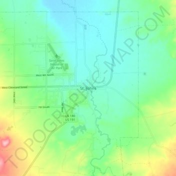
Name: St. Johns topographic map, elevation, terrain.
Location: St. Johns, Apache County, Arizona, 85936, United States (34.46587 -109.40093 34.54587 -109.32093)
Average elevation: 1,755 m
Minimum elevation: 1,714 m
Maximum elevation: 1,861 m