Geolocate

Bagnaia topographic map

Click on the map to display elevation.

About this map

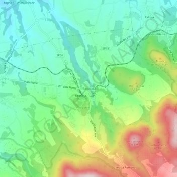
Name: Bagnaia topographic map, elevation, terrain.

Location: Bagnaia, Viterbo, Lazio, 01100, Italy (42.40835 12.13582 42.44835 12.17582)

Average elevation: 464 m

Minimum elevation: 335 m

Maximum elevation: 718 m

Gear up for your next adventure:

💧Hydration Bladder - Hands-free hydration solution for long treks
🌡️Emergency Mylar Blankets - Compact thermal protection for unexpected nights outdoors
🥾Waterproof Hiking Boots - Essential footwear for rugged terrain and wet Canadian trails
❄️Traction Ice Cleats - Slip-on spikes for icy trails and winter hiking
🥾Mountaineering Boots - Supportive boots for climbing and high-altitude hiking

As an Amazon Associate, this site earns from qualifying purchases at no extra cost to you.