
Thank you for supporting this site ❤️
Make a donation
Make a donation
Gear up for your next adventure:
As an Amazon Associate, this site earns from qualifying purchases at no extra cost to you.
Laspuña topographic map
Click on the map to display elevation.
Thank you for supporting this site ❤️
Make a donation
Make a donation
Gear up for your next adventure:
As an Amazon Associate, this site earns from qualifying purchases at no extra cost to you.
About this map
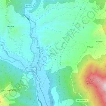
Name: Laspuña topographic map, elevation, terrain.
Location: Laspuña, Sobrarbe, Huesca, Aragón, 22363, España (42.48387 0.13512 42.52387 0.17512)
Average elevation: 779 m
Minimum elevation: 584 m
Maximum elevation: 1,412 m
Thank you for supporting this site ❤️
Make a donation
Make a donation
Gear up for your next adventure:
As an Amazon Associate, this site earns from qualifying purchases at no extra cost to you.