
Thank you for supporting this site ❤️
Make a donation
Make a donation
Gear up for your next adventure:
As an Amazon Associate, this site earns from qualifying purchases at no extra cost to you.
Fugging topographic map
Click on the map to display elevation.
Thank you for supporting this site ❤️
Make a donation
Make a donation
Gear up for your next adventure:
As an Amazon Associate, this site earns from qualifying purchases at no extra cost to you.
About this map
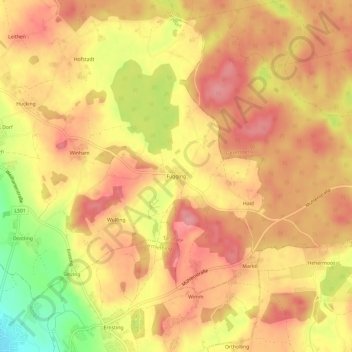
Name: Fugging topographic map, elevation, terrain.
Location: Fugging, Tarsdorf, Bezirk Braunau, 5121, Austria (48.04741 12.84234 48.08741 12.88234)
Average elevation: 470 m
Minimum elevation: 402 m
Maximum elevation: 504 m
Thank you for supporting this site ❤️
Make a donation
Make a donation
Gear up for your next adventure:
As an Amazon Associate, this site earns from qualifying purchases at no extra cost to you.