Geolocate

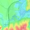
Avalon topographic map

Click on the map to display elevation.

About this map

Name: Avalon topographic map, elevation, terrain.

Location: Avalon, Geelong, Victoria, 3212, Australia (-38.09638 144.40060 -38.00137 144.49341)

Average elevation: 11 m

Minimum elevation: -10 m

Maximum elevation: 29 m

Other topographic maps

Click on a map to view its topography, its elevation and its terrain.

Alexander Webb Park

Australia > Victoria > Geelong

Average elevation: 22 m

Armstrong Creek

Australia > Victoria > Geelong

Average elevation: 47 m

Buckley Falls Park

Australia > Victoria > Geelong

Average elevation: 43 m

Hume Reserve

Australia > Victoria > Geelong

Average elevation: 32 m

Mount Duneed

Australia > Victoria > Geelong

Average elevation: 56 m

Wombat Hill

Australia > Victoria > Geelong

Average elevation: 40 m

Vincent Park

Australia > Victoria > Geelong

Average elevation: 10 m

Lincoln Reserve

Australia > Victoria > Geelong

Average elevation: 19 m

Gear up for your next adventure:

🥾Trail Hiking Boots - Supportive boots for rough trails
🔥Emergency Fire Starter - Reliable ignition source for all weather conditions
🛰️Satellite Messenger - Emergency communication for areas with no cell service
🩹Moleskin Blister Pads - Direct protection for painful foot pressure points
🧭GPS Tracker - Track your location in remote areas safely

As an Amazon Associate, this site earns from qualifying purchases at no extra cost to you.