
Thank you for supporting this site ❤️
Make a donation
Make a donation
Gear up for your next adventure:
As an Amazon Associate, this site earns from qualifying purchases at no extra cost to you.
Dasam topographic map
Click on the map to display elevation.
Thank you for supporting this site ❤️
Make a donation
Make a donation
Gear up for your next adventure:
As an Amazon Associate, this site earns from qualifying purchases at no extra cost to you.
About this map
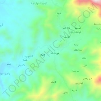
Name: Dasam topographic map, elevation, terrain.
Location: Dasam, Ad Dahrah, Al Qafr District, Ibb Governorate, Yemen (14.30846 44.11213 14.34846 44.15213)
Average elevation: 1,547 m
Minimum elevation: 1,359 m
Maximum elevation: 2,064 m
Thank you for supporting this site ❤️
Make a donation
Make a donation
Gear up for your next adventure:
As an Amazon Associate, this site earns from qualifying purchases at no extra cost to you.