
Palacode topographic map
Click on the map to display elevation.
About this map
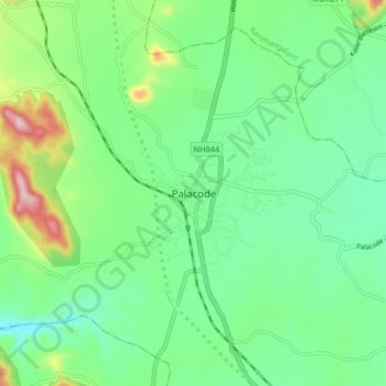
Name: Palacode topographic map, elevation, terrain.
Location: Palacode, Palakkodu, Dharmapuri, Tamil Nadu, 636808, India (12.26412 78.03288 12.34412 78.11288)
Average elevation: 518 m
Minimum elevation: 430 m
Maximum elevation: 741 m
Other topographic maps
Click on a map to view its topography, its elevation and its terrain.