Geolocate

Saccsamarca topographic map

Click on the map to display elevation.

About this map

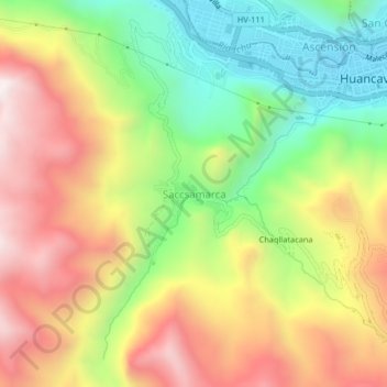
Name: Saccsamarca topographic map, elevation, terrain.

Location: Saccsamarca, Huancavelica, 09001, Perú (-12.81921 -75.01251 -12.77921 -74.97251)

Average elevation: 4,117 m

Minimum elevation: 3,669 m

Maximum elevation: 4,600 m

Gear up for your next adventure:

🎒Fully Waterproof Backpack - Total protection for photography gear and electronics
🧴Outdoor Sunscreen - High SPF protection for high-altitude UV exposure
🧦Hiking Socks - Moisture-wicking and comfortable socks for long hikes
Camping Groundsheet - Protect your tent from moisture and dirt
🕯️Camping Lantern - Illuminates your entire campsite with high-efficiency LEDs

As an Amazon Associate, this site earns from qualifying purchases at no extra cost to you.