
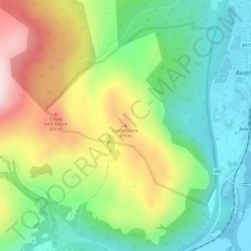
Craigellachie topographic map
Interactive map
Click on the map to display elevation.
About this map
Name: Craigellachie topographic map, elevation, terrain.
Average elevation: 367 m
Minimum elevation: 206 m
Maximum elevation: 627 m
Other topographic maps
Click on a map to view its topography, its elevation and its terrain.
Drumnadrochit
United Kingdom > Scotland > Inverness > Drumnadrochit
Drumnadrochit, Inverness, Highland, Scotland, IV63 6TX, United Kingdom
Average elevation: 159 m