
Thank you for supporting this site ❤️
Make a donation
Make a donation
Gear up for your next adventure:
As an Amazon Associate, this site earns from qualifying purchases at no extra cost to you.
Chaarir topographic map
Click on the map to display elevation.
Thank you for supporting this site ❤️
Make a donation
Make a donation
Gear up for your next adventure:
As an Amazon Associate, this site earns from qualifying purchases at no extra cost to you.
About this map
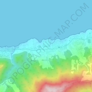
Name: Chaarir topographic map, elevation, terrain.
Location: Chaarir, Ténès, Daïra Ténès, Chlef, 02200, Algérie (36.48446 1.25560 36.52446 1.29560)
Average elevation: 95 m
Minimum elevation: 0 m
Maximum elevation: 490 m
Thank you for supporting this site ❤️
Make a donation
Make a donation
Gear up for your next adventure:
As an Amazon Associate, this site earns from qualifying purchases at no extra cost to you.