Geolocate

Corte topographic map

Click on the map to display elevation.

About this map

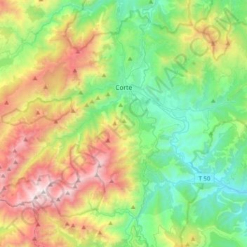
Name: Corte topographic map, elevation, terrain.

Location: Corte, Haute-Corse, Corsica, Metropolitan France, 20250, France (42.20317 8.92650 42.34467 9.21178)

Average elevation: 1,167 m

Minimum elevation: 221 m

Maximum elevation: 2,678 m

Gear up for your next adventure:

🦟Insect Repellent - Keep mosquitoes and black flies away in wooded areas
🥾Trekking Boots - Durable boots for long-distance trekking
👖Convertible Hiking Pants - Zip-off legs to adapt to changing weather conditions
🥾Durable Hiking Shoes - Long-lasting shoes for frequent hiking
🦶Hiking Shoe Insoles - Added support for high arches and long days on feet

As an Amazon Associate, this site earns from qualifying purchases at no extra cost to you.