Geolocate

Minateda topographic map

Click on the map to display elevation.

About this map

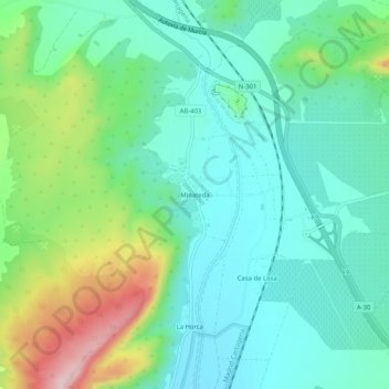
Name: Minateda topographic map, elevation, terrain.

Location: Minateda, Hellín, Albacete, Castilla-La Mancha, España (38.44662 -1.63169 38.48662 -1.59169)

Average elevation: 494 m

Minimum elevation: 416 m

Maximum elevation: 702 m

Gear up for your next adventure:

🥾Mountaineering Boots - Supportive boots for climbing and high-altitude hiking
🛏️Camping Sleeping Mat - Comfortable mats for sleeping outdoors
❄️Traction Ice Cleats - Slip-on spikes for icy trails and winter hiking
🥾Trekking Poles - Adjustable trekking poles to reduce knee stress and improve stability
Camping Essentials - All-in-one gear for a comfortable camping trip

As an Amazon Associate, this site earns from qualifying purchases at no extra cost to you.