Geolocate

Cochabamba topographic map

Click on the map to display elevation.

About this map

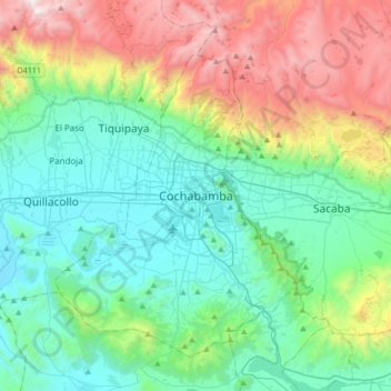
Name: Cochabamba topographic map, elevation, terrain.

Location: Cochabamba, Kanata, Cercado, Cochabamba, 922, Bolivia (-17.55361 -66.31690 -17.23361 -65.99690)

Average elevation: 3,145 m

Minimum elevation: 2,507 m

Maximum elevation: 4,825 m

Gear up for your next adventure:

🦌Outdoor Trail Camera - Monitor wildlife activity near your favorite spots
🛌Insulated Sleeping Pad - Critical thermal barrier between you and the cold ground
🔦UV Flashlight - Detect minerals or specific insects in the dark
🧴First Aid Kit - Essential first aid supplies for outdoor emergencies
🧢Sun Hat - Wide-brim hat for sun protection

As an Amazon Associate, this site earns from qualifying purchases at no extra cost to you.