Geolocate

Ashburn topographic map

Click on the map to display elevation.

About this map

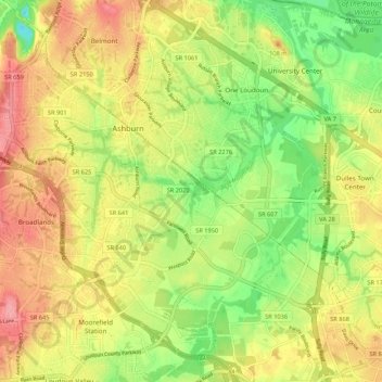
Name: Ashburn topographic map, elevation, terrain.

Location: Ashburn, Loudoun County, Virginia, United States (38.98815 -77.52292 39.07145 -77.43125)

Average elevation: 86 m

Minimum elevation: 36 m

Maximum elevation: 144 m

Gear up for your next adventure:

🌡️Emergency Mylar Blankets - Compact thermal protection for unexpected nights outdoors
🐕Hiking Dog Pack - Let your canine companion carry their own water and food
🦶Anti-Blister Balm - Prevents friction and hotspots during long ascents
🛁Quick-Dry Microfiber Towel - Space-saving towel that dries rapidly on the move
🗺️Topographic Maps - Detailed maps to explore trails, mountains, and wilderness areas

As an Amazon Associate, this site earns from qualifying purchases at no extra cost to you.