Geolocate

Toledo topographic map

Click on the map to display elevation.

About this map

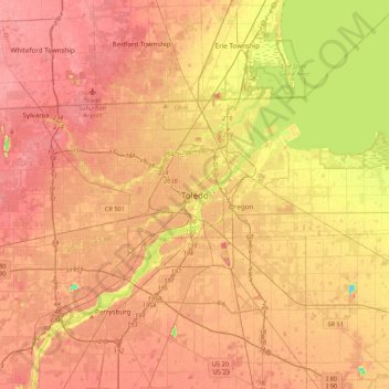
Name: Toledo topographic map, elevation, terrain.

Location: Toledo, Lucas County, Ohio, 43659, United States (41.49291 -83.69782 41.81291 -83.37782)

Average elevation: 189 m

Minimum elevation: 142 m

Maximum elevation: 214 m

Other topographic maps

Click on a map to view its topography, its elevation and its terrain.

Ottawa Park

United States > Ohio > Lucas County > Toledo

Average elevation: 189 m

Gear up for your next adventure:

🧴Outdoor Sunscreen - High SPF protection for high-altitude UV exposure
🧴Waterproofing Spray - Restore the DWR coating on jackets and tents
Camping Essentials - All-in-one gear for a comfortable camping trip
🥾Waterproof Hiking Shoes - Durable shoes for wet and rugged trails
🧥Waterproof Pants - Keep dry during rainy hiking conditions

As an Amazon Associate, this site earns from qualifying purchases at no extra cost to you.