Geolocate

Aurora topographic map

Click on the map to display elevation.

About this map

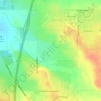
Name: Aurora topographic map, elevation, terrain.

Location: Aurora, Arapahoe County, Colorado, 80018, United States (39.69655 -104.74423 39.72557 -104.69720)

Average elevation: 1,699 m

Minimum elevation: 1,678 m

Maximum elevation: 1,720 m

Gear up for your next adventure:

🗺️Topographic Maps - Detailed maps to explore trails, mountains, and wilderness areas
🔦LED Headlamp - Hands-free lighting for early morning starts or late finishes
Camping Groundsheet - Protect your tent from moisture and dirt
❄️Traction Ice Cleats - Slip-on spikes for icy trails and winter hiking
🩹Moleskin Blister Pads - Direct protection for painful foot pressure points

As an Amazon Associate, this site earns from qualifying purchases at no extra cost to you.