Geolocate

Llovio topographic map

Click on the map to display elevation.

About this map

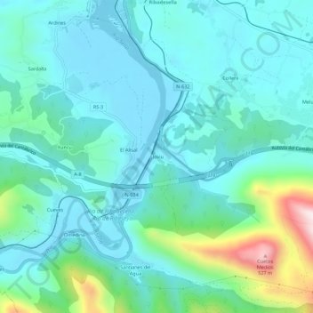
Name: Llovio topographic map, elevation, terrain.

Location: Llovio, Ribadesella, Asturias, 33560, España (43.41881 -5.07572 43.45881 -5.03572)

Average elevation: 103 m

Minimum elevation: -5 m

Maximum elevation: 555 m

Gear up for your next adventure:

🧥Waterproof Jacket - Lightweight rain jackets for hiking and outdoor activities
👟Leg Gaiters - Keep debris, mud, and snow out of your boots
🧳Compression Sacks - Maximize space in your backpack by shrinking gear
Camping Tent - Weather-resistant tents suitable for 2 to 6 people
💡LED Headlamp - Hands-free illumination for night hiking and camping

As an Amazon Associate, this site earns from qualifying purchases at no extra cost to you.