Geolocate

Davos topographic map

Click on the map to display elevation.

About this map

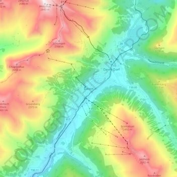
Name: Davos topographic map, elevation, terrain.

Location: Davos, Prättigau/Davos, Grisons, 7270, Switzerland (46.75620 9.78369 46.83620 9.86369)

Average elevation: 2,007 m

Minimum elevation: 1,488 m

Maximum elevation: 2,832 m

Gear up for your next adventure:

🥾Trail Hiking Socks - Comfortable socks to prevent blisters and fatigue
👟Trail Running Shoes - Agile footwear for fast-paced topographic exploration
🧥Ultralight Puffy Jacket - Maximum warmth that packs down to the size of an orange
🥾Trekking Boots - Durable boots for long-distance trekking
💡Compact LED Flashlight - Powerful and portable flashlight for outdoor use

As an Amazon Associate, this site earns from qualifying purchases at no extra cost to you.