Geolocate

Toa Alta topographic map

Click on the map to display elevation.

About this map

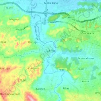
Name: Toa Alta topographic map, elevation, terrain.

Location: Toa Alta, Puerto Rico, 00626, United States (18.34871 -66.28797 18.42871 -66.20797)

Average elevation: 60 m

Minimum elevation: -1 m

Maximum elevation: 225 m

Gear up for your next adventure:

🪑Ultralight Camping Stool - Compact seating for rest stops during long hikes
❄️Traction Ice Cleats - Slip-on spikes for icy trails and winter hiking
🪑Insulated Seat Pad - Protect your seat from cold rocks and wet logs
🥾Approach Shoes - Shoes designed for climbing approaches and rugged trails
🕯️Camping Lantern - Illuminates your entire campsite with high-efficiency LEDs

As an Amazon Associate, this site earns from qualifying purchases at no extra cost to you.