
Carcajou topographic map
Interactive map
Click on the map to display elevation.
About this map
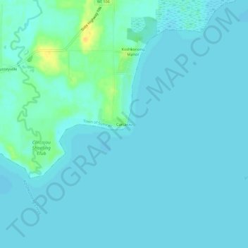
Name: Carcajou topographic map, elevation, terrain.
Average elevation: 239 m
Minimum elevation: 235 m
Maximum elevation: 259 m
Other topographic maps
Click on a map to view its topography, its elevation and its terrain.
Lake Ripley
United States > Wisconsin > Jefferson County > Town of Oakland
Lake Ripley, Town of Oakland, Jefferson County, Wisconsin, United States
Average elevation: 262 m