Geolocate

Longview topographic map

Click on the map to display elevation.

About this map
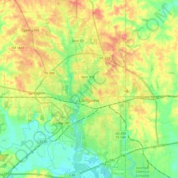
Name: Longview topographic map, elevation, terrain.

Location: Longview, Gregg County, Texas, United States (32.43153 -94.84434 32.58956 -94.66335)

Average elevation: 105 m

Minimum elevation: 68 m

Maximum elevation: 158 m

Other topographic maps

Click on a map to view its topography, its elevation and its terrain.
Liberty City

United States > Texas > Gregg County

Average elevation: 116 m

Gladewater Park

United States > Texas > Gregg County

Average elevation: 98 m

Gear up for your next adventure:

🥾Durable Hiking Shoes - Long-lasting shoes for frequent hiking
🚑Survival Whistle - Signal for help across long distances in mountains
🧦Crew Hiking Socks - Comfortable socks for long-distance hikes
🧴Outdoor Sunscreen - High SPF protection for high-altitude UV exposure
🦶Hiking Shoe Insoles - Added support for high arches and long days on feet

As an Amazon Associate, this site earns from qualifying purchases at no extra cost to you.