Geolocate

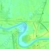
Bulihan topographic map

Click on the map to display elevation.

About this map

Name: Bulihan topographic map, elevation, terrain.

Location: Bulihan, Plaridel, Bulacan, Central Luzon, Philippines (14.86259 120.88407 14.88021 120.91477)

Average elevation: 8 m

Minimum elevation: 4 m

Maximum elevation: 14 m

Other topographic maps

Click on a map to view its topography, its elevation and its terrain.

Sipat

Philippines > Bulacan > Plaridel

Average elevation: 8 m

Lalangan

Philippines > Bulacan > Plaridel

Average elevation: 9 m

Isla de Pulilan

Philippines > Bulacan > Plaridel > Banga Ⅱ

Average elevation: 10 m

Banga Ⅰ

Philippines > Bulacan > Plaridel

Average elevation: 10 m

Lumang Bayan

Philippines > Bulacan > Plaridel

Average elevation: 10 m

Banga Ⅰ

Philippines > Bulacan > Plaridel

Average elevation: 10 m

Lumang Bayan

Philippines > Bulacan > Plaridel

Average elevation: 10 m

Gear up for your next adventure:

🧦Hiking Liner Socks - Thin base layer to prevent friction and blisters
🧣Evaporative Cooling Towel - Beat the heat during intense summer climbs
🥤Collapsible Travel Cup - Saves space and weight in your mess kit
🧼Biodegradable Camp Soap - Environmentally friendly cleaning for gear and body
🛁Quick-Dry Microfiber Towel - Space-saving towel that dries rapidly on the move

As an Amazon Associate, this site earns from qualifying purchases at no extra cost to you.