Geolocate

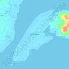
Sinubung topographic map

Click on the map to display elevation.

About this map

Name: Sinubung topographic map, elevation, terrain.

Location: Sinubung, Zamboanga City, Zamboanga Peninsula, 7000, Philippines (7.00284 121.90766 7.04284 121.94766)

Average elevation: 58 m

Minimum elevation: 0 m

Maximum elevation: 586 m

Other topographic maps

Click on a map to view its topography, its elevation and its terrain.

Sacol Island

Philippines > Zamboanga City

Average elevation: 6 m

Vitali River

Philippines > Zamboanga City > Mangusu

Average elevation: 27 m

Sinunug Island

Philippines > Zamboanga City

Average elevation: 0 m

Plaza Pershing

Philippines > Zamboanga City

Average elevation: 4 m

Gear up for your next adventure:

🛏️Camping Sleeping Mat - Comfortable mats for sleeping outdoors
🥾Mountain Hiking Boots - High-traction boots for rocky terrain
🧊Insulated Water Bottle - Keeps drinks cold in summer and prevents freezing in winter
🧢Outdoor Cap - Protective cap for sun and rain during hikes
🧣Evaporative Cooling Towel - Beat the heat during intense summer climbs

As an Amazon Associate, this site earns from qualifying purchases at no extra cost to you.