Geolocate

Ramer topographic map

Click on the map to display elevation.

About this map
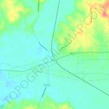
Name: Ramer topographic map, elevation, terrain.

Location: Ramer, McNairy County, Tennessee, United States (35.06178 -88.64458 35.08180 -88.59162)

Average elevation: 132 m

Minimum elevation: 115 m

Maximum elevation: 172 m

Gear up for your next adventure:

💡Solar Camping Lamp - Eco-friendly lighting for campsites
🧭GPS Outdoor Watch - Smart watch for navigation and fitness tracking in nature
🛏️Sleeping Bag - Warm and compact sleeping bags for outdoor camping
🥽Outdoor Goggles - Protective eyewear for outdoor activities
🥾Approach Boots - Comfortable boots for hiking and climbing approaches

As an Amazon Associate, this site earns from qualifying purchases at no extra cost to you.