
Thank you for supporting this site ❤️
Make a donation
Make a donation
Gear up for your next adventure:
As an Amazon Associate, this site earns from qualifying purchases at no extra cost to you.
Pesaro topographic map
Click on the map to display elevation.
Thank you for supporting this site ❤️
Make a donation
Make a donation
Gear up for your next adventure:
As an Amazon Associate, this site earns from qualifying purchases at no extra cost to you.
About this map
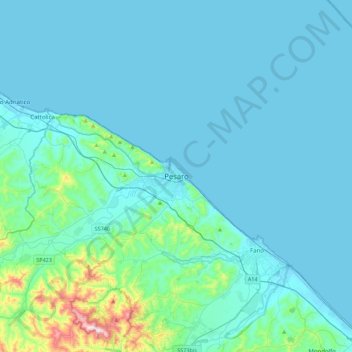
Name: Pesaro topographic map, elevation, terrain.
Location: Pesaro, Pesaro e Urbino, Marche, 61121, Italia (43.74981 12.75312 44.06981 13.07312)
Average elevation: 51 m
Minimum elevation: -3 m
Maximum elevation: 549 m
Thank you for supporting this site ❤️
Make a donation
Make a donation
Gear up for your next adventure:
As an Amazon Associate, this site earns from qualifying purchases at no extra cost to you.
Other topographic maps
Click on a map to view its topography, its elevation and its terrain.
Giardini di porta Rimini - Oltremercato
Italia > Marche > Pesaro e Urbino > Pesaro
Average elevation: 13 m