
Thank you for supporting this site ❤️
Make a donation
Make a donation
Gear up for your next adventure:
As an Amazon Associate, this site earns from qualifying purchases at no extra cost to you.
Löwygrube topographic map
Click on the map to display elevation.
Thank you for supporting this site ❤️
Make a donation
Make a donation
Gear up for your next adventure:
As an Amazon Associate, this site earns from qualifying purchases at no extra cost to you.
About this map
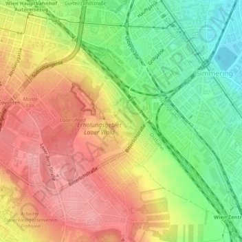
Name: Löwygrube topographic map, elevation, terrain.
Location: Löwygrube, KG Oberlaa Stadt, Favoriten, Vienna, 1100, Austria (48.16137 16.40235 48.16673 16.41002)
Average elevation: 208 m
Minimum elevation: 155 m
Maximum elevation: 253 m
Thank you for supporting this site ❤️
Make a donation
Make a donation
Gear up for your next adventure:
As an Amazon Associate, this site earns from qualifying purchases at no extra cost to you.