
雾里 topographic map
Interactive map
Click on the map to display elevation.
About this map
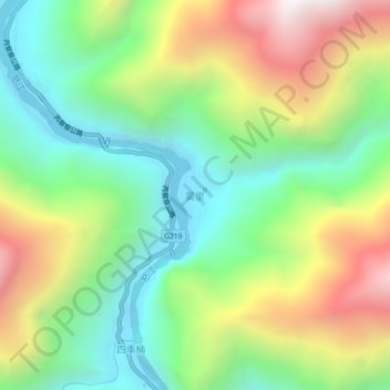
Name: 雾里 topographic map, elevation, terrain.
Location: 雾里, 贡山独龙族怒族自治县, 怒江傈僳族自治州, 云南省, 中国 (28.04001 98.58026 28.08001 98.62026)
Average elevation: 2,107 m
Minimum elevation: 1,540 m
Maximum elevation: 3,027 m