Geolocate

Manzanar topographic map

Click on the map to display elevation.

About this map

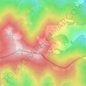
Name: Manzanar topographic map, elevation, terrain.

Location: Manzanar, Villavelayo, La Rioja, 09679, España (42.09124 -3.01337 42.09134 -3.01327)

Average elevation: 1,558 m

Minimum elevation: 1,172 m

Maximum elevation: 1,861 m

Gear up for your next adventure:

💧Collapsible Water Bottle - Space-saving water bottle for outdoor activities
🧭Orienteering Kit - Tools for map reading and navigation in the wild
🧴Sunscreen SPF - Broad-spectrum sunscreen for outdoor activities
🧥Waterproof Jacket - Lightweight rain jackets for hiking and outdoor activities
🧢Sun Hat - Wide-brim hat for sun protection

As an Amazon Associate, this site earns from qualifying purchases at no extra cost to you.