
Thank you for supporting this site ❤️
Make a donation
Make a donation
Gear up for your next adventure:
As an Amazon Associate, this site earns from qualifying purchases at no extra cost to you.
Sandhikharka topographic map
Click on the map to display elevation.
Thank you for supporting this site ❤️
Make a donation
Make a donation
Gear up for your next adventure:
As an Amazon Associate, this site earns from qualifying purchases at no extra cost to you.
About this map
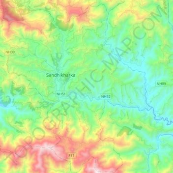
Name: Sandhikharka topographic map, elevation, terrain.
Location: Sandhikharka, Arghakhanchi, Lumbini Province, 32700, Nepal (27.89039 83.05586 28.04051 83.21672)
Average elevation: 1,245 m
Minimum elevation: 773 m
Maximum elevation: 2,260 m
Thank you for supporting this site ❤️
Make a donation
Make a donation
Gear up for your next adventure:
As an Amazon Associate, this site earns from qualifying purchases at no extra cost to you.