

Ponce topographic map
Click on the map to display elevation.
Ponce
Elevations include Cerro de Punta at 4,390 feet (1,338 m), the highest in Puerto Rico, located in Barrio Anón in the territory of the municipality of Ponce. Mount Jayuya, at 4,314 feet (1,315 m) is located on the boundary between Barrio Anón and Barrio Saliente in Jayuya. Cerro Maravilla, at nearly 3,970 feet (1,210 m) above sea level, is located to the east of Barrio Anón. There are many other mountains at lower elevations in the municipality, such as the Montes Llanos ridge and Mount Diablo, at 2,231 feet (680 m) and Mount Marueño, at 2,100 feet (640 m), and Pinto Peak, among others. Part of the Toro Negro Forest is located in Barrio Anón. Coastal promontories include Cuchara, Peñoncillo, Carnero, and Cabullón points. Fifty-six (56) percent of the municipality consists of slopes 10 degrees or greater.
About this map
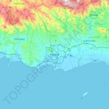
Name: Ponce topographic map, elevation, terrain.
Location: Ponce, Puerto Rico, 00730, United States (17.85156 -66.77396 18.17156 -66.45396)
Average elevation: 189 m
Minimum elevation: -1 m
Maximum elevation: 1,298 m