Geolocate

Kenyon topographic map

Click on the map to display elevation.

About this map

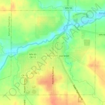
Name: Kenyon topographic map, elevation, terrain.

Location: Kenyon, Goodhue County, Minnesota, United States (44.26202 -93.00557 44.28378 -92.96996)

Average elevation: 351 m

Minimum elevation: 328 m

Maximum elevation: 371 m

Other topographic maps

Click on a map to view its topography, its elevation and its terrain.

Frontenac

United States > Minnesota > Goodhue County

Average elevation: 243 m

Gear up for your next adventure:

Camping Essentials - All-in-one gear for a comfortable camping trip
🕶️Polarized Sunglasses - Reduces glare from snow and water at high elevations
🧴Bear Spray Holster - Quick-access carry for essential Canadian wilderness safety
Family Camping Tent - Spacious tent suitable for family camping trips
🔭Compact Binoculars - Lightweight optics for scouting trails and wildlife

As an Amazon Associate, this site earns from qualifying purchases at no extra cost to you.